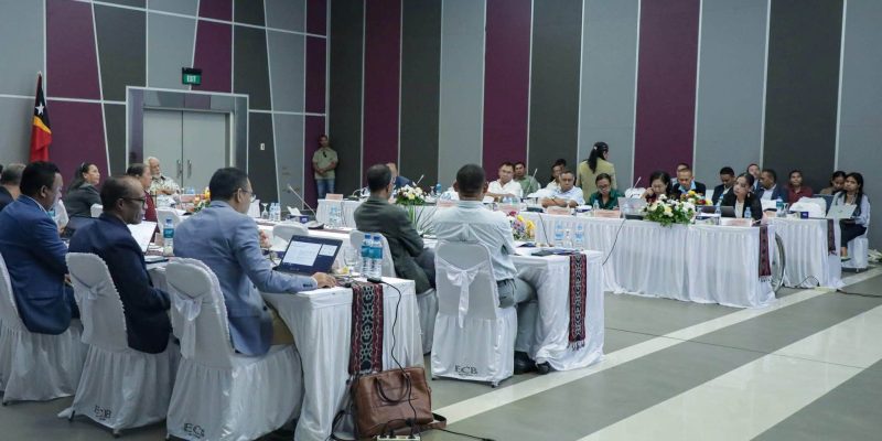


DILI, 24 january 2023 ( TATOLI)– United Nations Development Programme ( UNDP) together with the Secretary of State of Environment ( SSE) and the Secretay State of Civil Protection ( SSCP) today launched a Multi – hard Vulnerability and Risk Assessment Maps (MHVRA) of Timor – Leste.
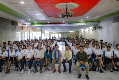
The Multi Hard Vulnerability and Risk Assessment Maps (MHVRA) was launched in a workshop held by the UNDP, and Government SSE and SCCP on climate change.
At the launching of the MHVRA, UNDP Resident Representative, Munchtuya Altangerel said the purpose of this workshop is to share and validate the final version of the MHVRA maps and produce the hazard map, Risk Profile, and Socio-Economic Vulnerability assessment.
“The National Workshop on Multi – hard Vulnerability and Risk Assessment ( MHVRA) maps are very crucial to support the Municipal Authorities and the relevant state institutions in Safeguarding Rural Communities and their Physical Assets from Climate-Induced Disasters in Timor – Leste,” the Resident Representative of UNDP in Timor – Leste, Munchtuya Altangerel told reporters in Hotel Timor, Colmera Dili, on tuesday.
Altangerel added that today’s event will be followed by a series of training including Local Vulnerability Risk Assessment, Disaster Risk Management Training, Advance Drone Training, MHVRA tools, and Socio-Economic Survey for effective use and application of these resources.
” UNDP will continue to follow up support provided by UNDP, coordinate with other departments and improve or for maximizing its effectiveness for better Disaster Risk Management and Climate Resilient planning,” she said.
The Secretary of State of Civil Protection, Joaquim José dos Reis Martins said, that utilizing maps is very crucial adding that it will help the relevant Ministry such as the Ministry of Public Works to detect the early natural disaster risk before the construction of the National roads and bridges for built with resilient to prevent the natural disaster in Timor – Leste.
“The launching of mapping is very crucial and will be stored in the National Laboratory of SSCP for used in detecting the national disaster risk across Timor – Leste,” he said.
Meanwhile the Secretary of State of Environment, Demetrio do Amaral de Carvalho appreciated the UNDP’s initiative for organizing the national Workshop.
” We will use the MHVRA maps to identify the projects which had destroyed by the natural disasters on april 4, 2020 to reconstruct more resilient projects in safeguarding rural communities and their physical assets from climate-induced disasters in Timor – Leste,” he said.
The Project of Timor – Leste Mapping is focused on 10 components of Natural disasters with a budget of $1,2 million from UNDP and Green Climate Fund (GCF) to prevent earthquakes, landslides, volcanic eruptions, floods, hurricanes, tornadoes, blizzards, tsunamis, cyclones, wildfires, and pan GBdemics to safeguarding rural communities and their physical assets against climate-induced disasters in Timor – Leste
Participated in the workshops were the President of Authority and Administrations from respective Municipalities, the staff of the Ministry of Agriculture and Fisheries, the Ministry of Public Works ( MPW), the Ministry of Planning and Territory, SSE, SSCP, and the staffs of IPG in Timor – Leste.
Journalist: Camilio de Sousa
Editor : Nelia B.